Connect with nature and discover the plants, animals and history of Warriewood Wetlands on our new self-guided walk.
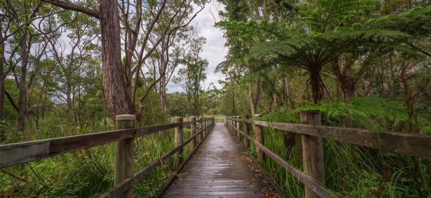
Scan the nine QR codes along the 2.4km walkway to learn about the distinct vegetation and habitat types that make up the largest remaining sand plain wetland in northern Sydney.
Warriewood Wetlands covers 26 hectares and supports several endangered ecological plant communities and critically endangered animal species.
Bird watchers will delight in the chance to see over 150 bird types including the endangered Regent Honeyeater, the Goshawk and Powerful Owl.
Explore the natural beauty in a non-invasive way along the boardwalk and look for ducks and swamp hens amongst the reeds.
Listen for the chorus of the wetlands in this important frog habitat. If you’re lucky, you may catch a glimpse of a microbat, such as the large-footed myotis, which is the only bat species in Australia to capture fish for food.
Notice distinct changes in vegetation including casuarina and swamp mahogany forests, and endangered swamp sclerophyll forest.
Along the way, check out water-sensitive urban designs which mimic the wetland’s natural capacity to filter and cleanse water.
Northern Beaches Council owns and manages this freshwater wetland system, which is fed by Narrabeen, Fern and Mullet Creeks, and flows into Narrabeen Lagoon.
Since it was purchased in 1996, the wetlands have been transformed from a weed-infested swamp to the beautiful and functional wetland you see today.
The wetlands form part of an important wildlife corridor running from Ku-ring-gai National Park via Ingleside Escarpment, down to Narrabeen Lagoon.
Spend time walking through this calming, natural setting to cultivate feelings of connection to and respect for nature.
The Warriewood Wetlands self-guided walk can be accessed from Katoa Close, Warriewood.